
Coverage Maps 2026 release highlights
The 2026 GSMA Coverage Maps release is now available to both existing and new customers, providing the latest insights into global mobile network coverage.
The 2026 release provides the latest insights into global mobile network coverage worldwide.
Whats new in 2026?
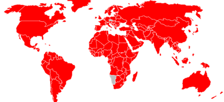
- Historical annual coverage maps (2010–2025) for 196 countries, showing coverage at a country level. Separate layers are available for 2G, 3G, 4G, and 5G networks, offering high-resolution insights.
- Clear metadata summarizing data sources, update history, and technical parameters.
- Historical coverage maps going back to 1999, allowing users to track the evolution of mobile networks over time.
- Crowdsourced coverage layers, providing additional insight beyond operator-reported data.
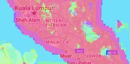
The maps offer high-resolution coverage down to street level, with signal strength classifications to reflect connection quality.
Upgraded features
Global datasets of current and historical mobile network coverage
Separate coverage layers for 2G, 3G, 4G and 5G networks
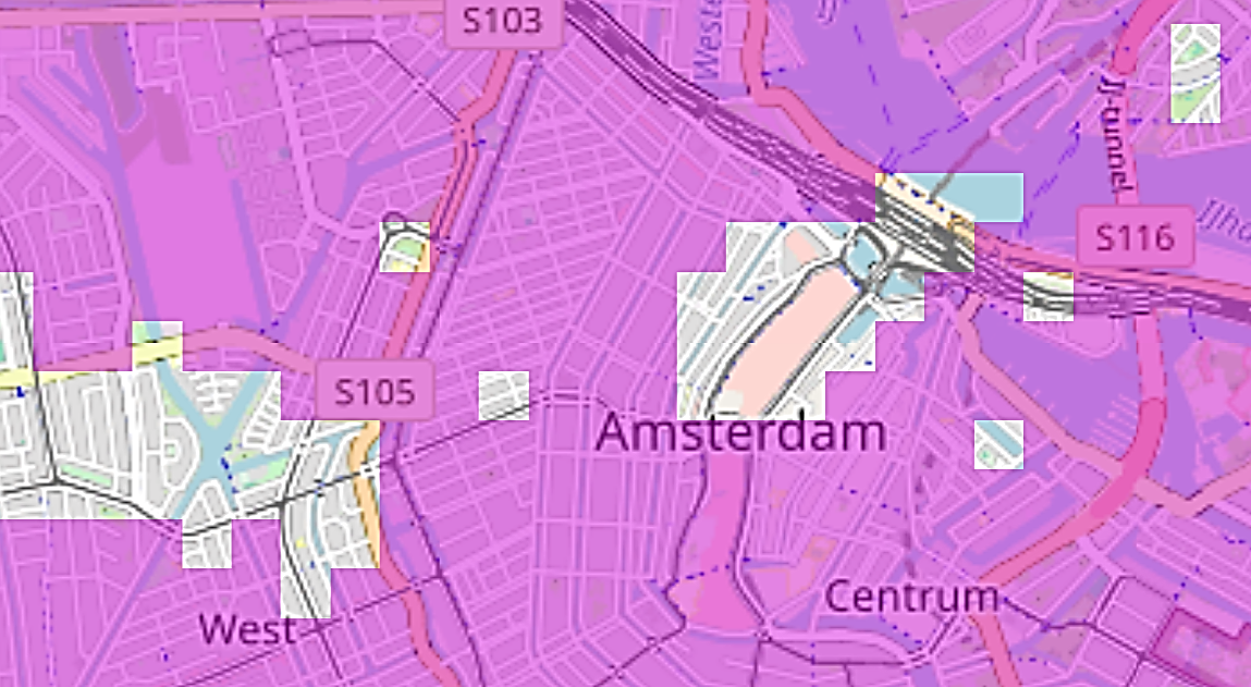
High-resolution coverage allowing for street-level view
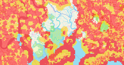
Signal strength classification to reflect the quality of connection
What insights can the coverage maps support?
Industrial
GSMA Coverage Maps can support your application, device or use case. Whether this is to provide your clients with information on where the devices can connect to given network generation, to operational decisions in logistics based on network availability near railways, roads and shipping routes.
Bespoke analytics
As research experts focusing on connectivity and its impacts, we offer bespoke analysis, from network coverage visualisation tools and dashboards to rigorous impact studies. Our team includes over 40 highly-specialised analysts, from geospatial data scientists to economists and IoT and spectrum domain experts.
Policymakers and regulators
For in-house analytics and research to inform policy decisions, from identifying underserved areas, to benchmarking network availability against peers. The GSMA Coverage Maps provide reliable data to support evidence-based policymaking.
Research and academia
To support research on the socio-economic impacts of connectivity.Historical coverage data serve as a unique source to track availability of mobile telephony and mobile internet. High-resolution data means data can easily be linked to individual and firm-level datasets.